In 1572, the Dutch Abraham Ortelius published a famous world atlas called Theatrum Orbis Terrarum. It was the first work of its kind and caused a worldwide sensation. The magnificent atlas fascinated both the copperplate engraver and the Frans Hogenberg who decided to expand the Dutch work with unique and fantastic urban landscapes. The so-called Civitates Orbis Terrarum is a collection of 600 copper engravings color displaying the most popular citiesof the medieval world. It is one of the most appreciated works of the German Renaissance.
Pioneer in cartographic representation
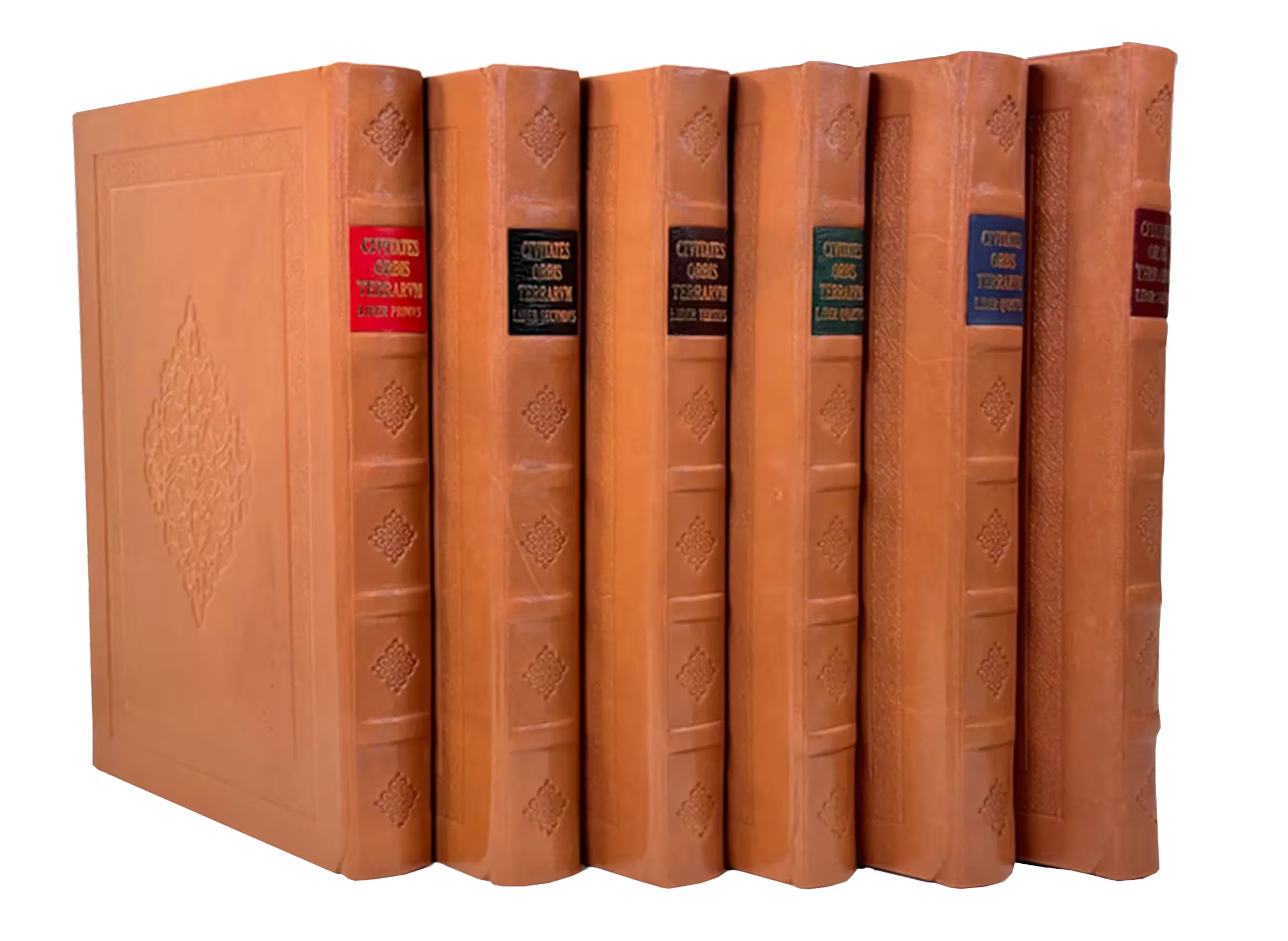
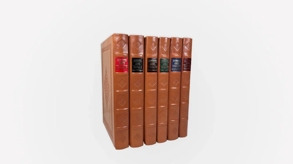
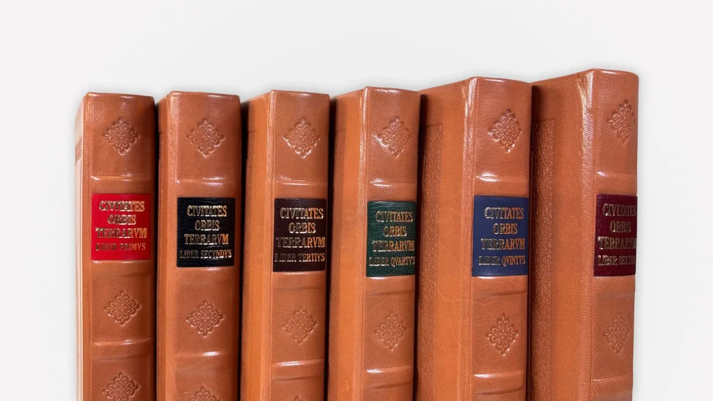
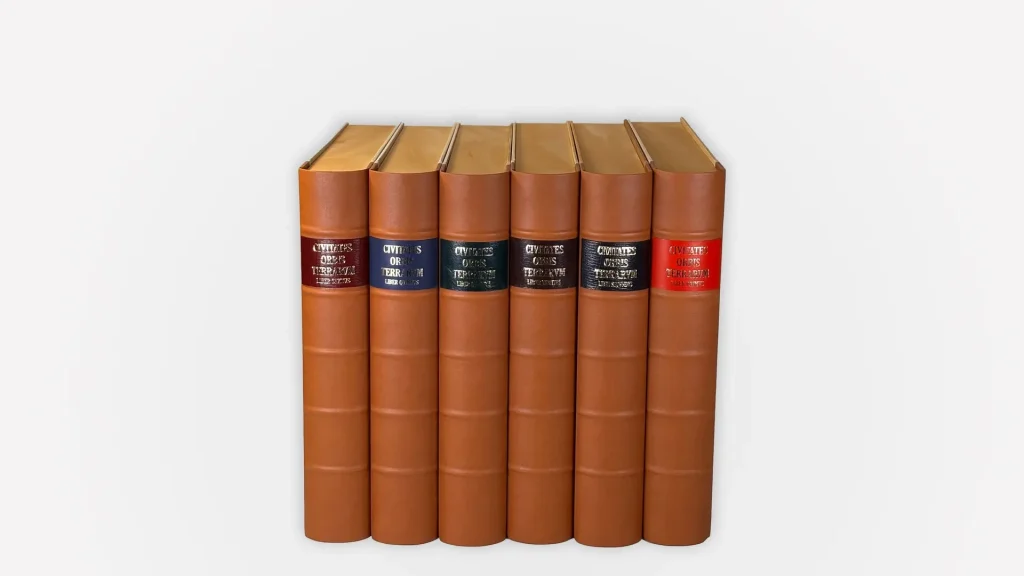
The Civitates Orbis Terrarum publication covers more than 600 realistic cityscapes and city maps with a total length of approximately 1600 pages. It was published in six volumes between 1572 and 1618 and shows all the major cities of Europe, Africa, Asia and even America.
Georg Braun, a theologian who lived from 1541 to 1622, was the editor. Frans Hogenberg was the engraver of the first four volumes. He had already made several maps for Abraham Ortelius. The fifth and sixth volumes were completed by Simon van den Neuwel.
From Jerusalem, Istanbul y Moscow, to Rome, Venice, London y Paris. Let yourself be seduced by Bilbao, Barcelona, Burgos y Seville.
And, across the ocean, Mexico y Cuzco, which appear for the first time represented, as well as exotic and remote locations such as Cairo, Cairo, Cairo, Cairo.
Artisan hands, the essence of each volume
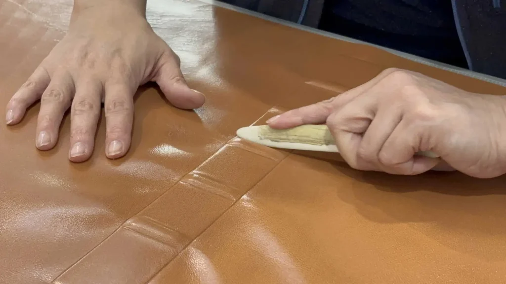
The first step in our process is the skin nut, where we precisely cut to achieve a finer, more flexible and manageable texture.
With craftsmanship, We use the chifla, an exclusive tool that gives its name to this technique, to treat the most delicate areas, ensuring the best results. smooth and elegant finish. The result is a masterpiece that radiates luxury and refinement.
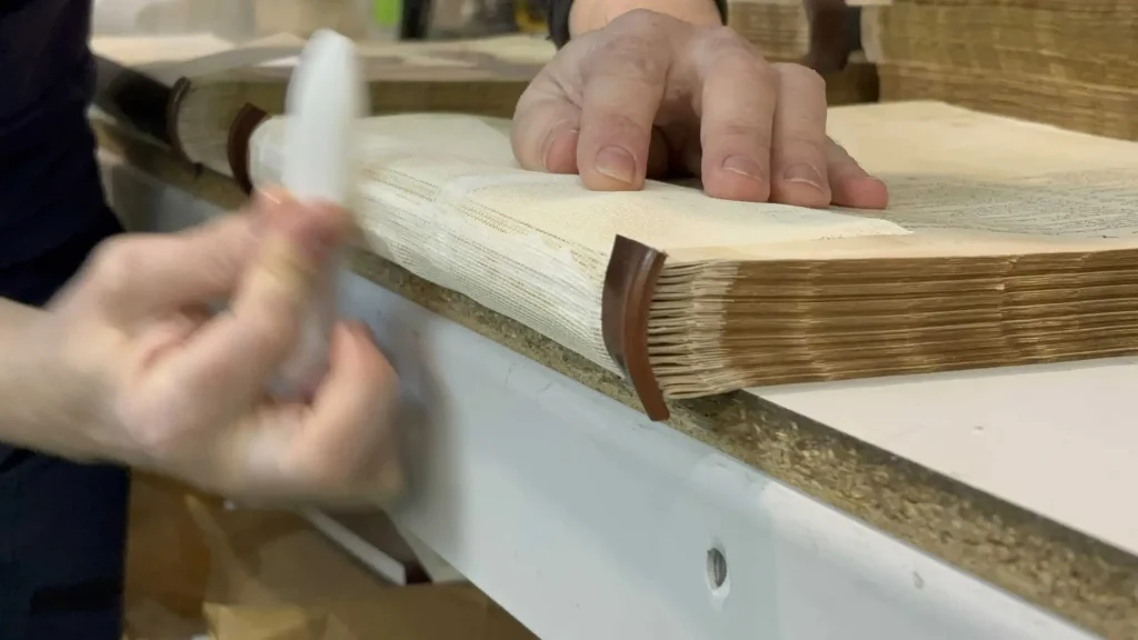
Each of the six volumes is bound by our master craftsmen using the handcrafted technique of the escartivana, which provides a unmatched authenticity and feel.
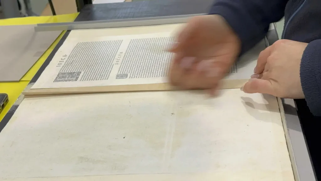
After securing the booklet in the printing press, are sewn by hand, sheet by sheet, with 9 stitches on the spine, ensuring durability and a sublime reading experience.
The more than 700 pages are precisely assembled by means of the scartivana, a delicate strip of paper that ensures a perfect and robust union.
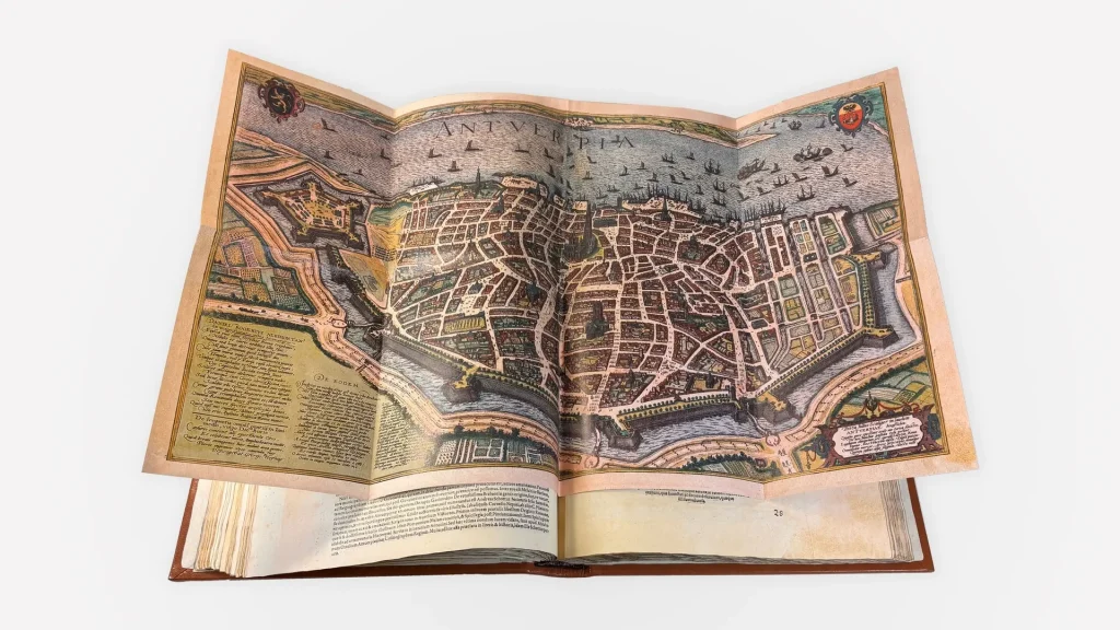
This process is vital in cartographic facsimiles, allowing the book to be opened completely without losing details.
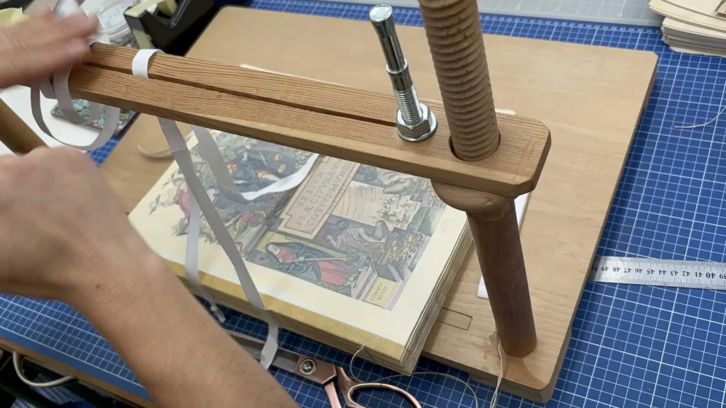
After stitching and gluing, the next step is the rounded spine, which requires precision and skill to achieve a perfect finish.
The curvature of the spine makes it easier for the pages to sit perfectly when the book is closed, protecting them from wear and tear and deformation. In addition, it provides a more robust and resistant surface.
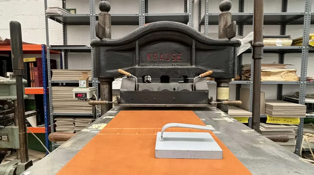
The goatskin covers are subjected to a thermal stamping with a Krause machine of 1900, unique in Spain by means of the embossing technique.
This process consists of printing the skin at 90ºC dry and with high pressure, perfectly marking the design with plateresque motifs. replicating the details of the originals preserved in prestigious libraries such as the Historical Library of Salamanca and the National Library of Spain.
Experience the World as it was in the 16th and 17th Centuries
The paper has been designed to simulate the texture and feel of the materials of that era. This fusion of authenticity and durability guarantees a reading experience that will transport you back in time.
This fusion of authenticity and durability guarantees a reading experience that will take you back in time.
History
Art
Innovation
Handcrafted with time and expertise
Backed by state-of-the-art technologies, our high-definition images, captured by highly specialized equipment, recreate every detail and nuance of the original masterpieces with astonishing accuracy.
In this way, we are able to capture even the subtlest textures and the most delicate colors, offering a visual sensation that was previously unimaginable.
An almost impossible feat to achieve
The creation of this edition has involved a 10-year effort to provide the following information a reproduction that accurately and precisely reflects the original vision of Braun and Hogenberg.
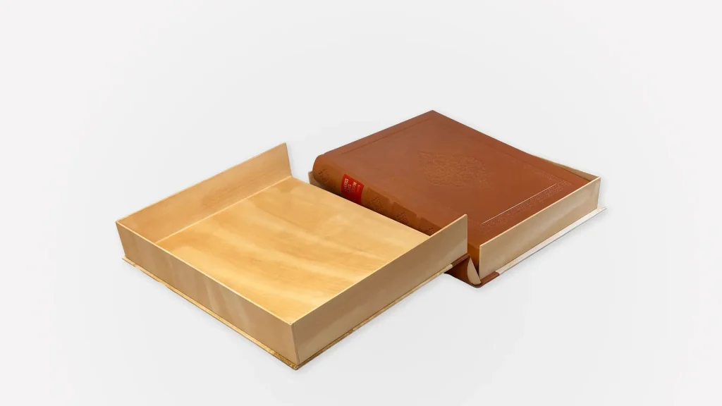
Each set is designed to endure over time including a protective case luxuriously finished with a ribbon, adorned with the iconic frontispieces of the original, which adds an additional touch of authenticity and elegance.
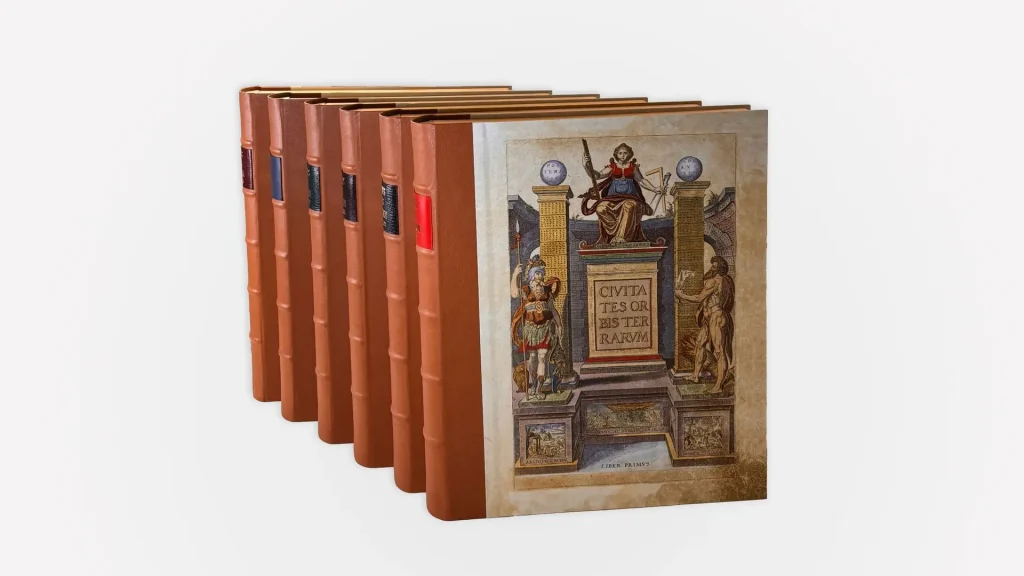
Civitates Orbis Terrarum
The world's first city atlas
Created by Georg Braun y Frans Hogenberg in the heart of the European Renaissance (1572, 1575, 1581, 1588, 1598 and 1617) in Cologne, Germany.
The engraver for the first four volumes was the Flemish artist Frans Hogenberg (1535-1595). He had also prepared several maps for Ortelius' atlas. The engravings of the fifth and sixth volumes were the work of Simon van den Neuwel (1538-1590)
Certification of authenticity. Institutional support of renown assures its importance and legitimate origin.
The 1300 pages distributed in 6 volumes are a testimony to the breadth and depth of the geographic knowledge of the time, presented in a manageable format of 36 x 25 cm that perfectly balances size and readability.
Enriched by a STUDY BOOK in charge of Jose Luis Casado Soto, reviewed and annotated by Agustin Hernando Rica.
The originals are distributed among the National Library of Spain (BNE): R/22248-250, ER/4684-86 and the Historical Library of the University of Salamanca (BGUSAL): BG/32146-32151.