A cartographic journey with our deluxe editions: handcrafted facsimiles of nautical charts, pioneering atlases and urban views that transformed the perception of the world.
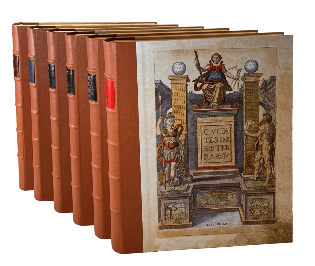
Civitates Orbis Terrarum
The complete and definitive facsimile edition of the work that changed the vision of the world. It is a spectacular visual and cultural journey through the world as it was known in the 16th century.
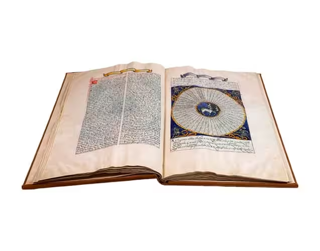
The most influential work of astrology and astronomy of the Middle Ages, compiled by Alfonso X the Wise, facsimile edition made with absolute fidelity to the original manuscript. Hand-bound following techniques of more than 400 years ago. A volume for lovers of ancient knowledge, history and collecting.
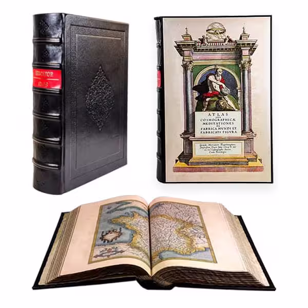
A milestone for being the first to use the Mercator projection, an innovation that corrects for the curvature of the Earth by representing it on a flat surface. Our facsimile edition accurately reproduces the 17th century binding.
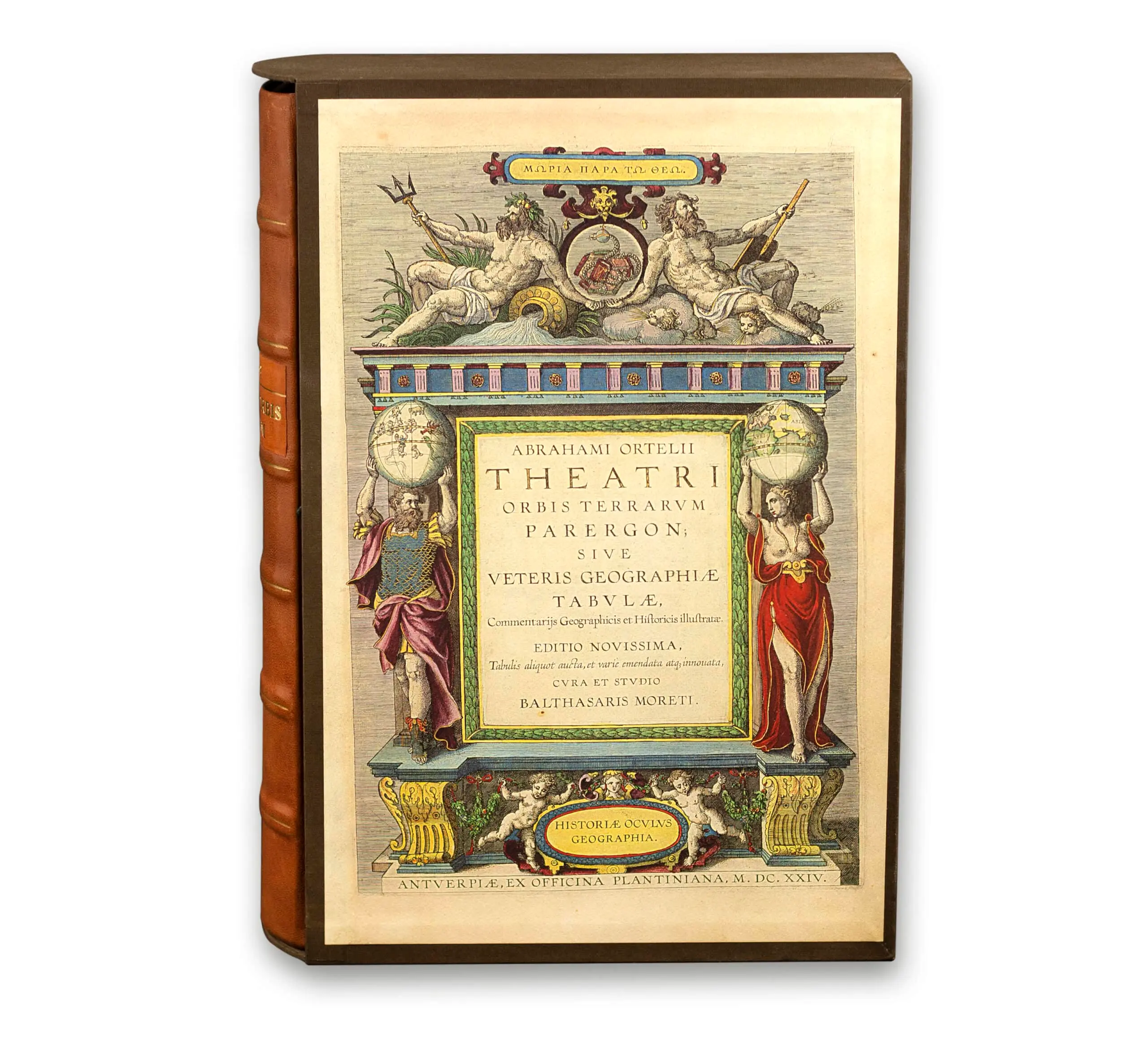
The first atlas in history. This atlas was crucial for the development of Renaissance cartography by setting standards such as the orientation of maps to the north and the compilation in a single volume.
The most important example of medieval nautical cartography. Produced on parchment and dated 1439, it offers a detailed representation of the Mediterranean Sea, the Black Sea, the Sea of Azov and the Atlantic coasts of Europe and North Africa.